Nature · Landscape reserve
Suta de Movile: over 3,500 mounds, not a hundred
It is called the Hundred Mounds, but there are over three and a half thousand. They stretch for eight kilometres beside the Prut, some are thirty metres high, and even now nobody is certain how they appeared.
In short
- The reserve covers 1,072 hectares and lies between the villages of Braniste, Riscani district, and Cobani, Glodeni district, beside the Prut.
- It holds over 3,500 mounds, from 1 metre to 30 metres high. The tallest is called the Gypsy's Mound. The strip is 8 km long and between 1.7 and 2.3 km wide.
- The origin is unresolved. There is talk of underwater reefs about 20 million years old, of landslides and ground settling, or, in the villagers' version, of burial mounds left after old battles.
The name misleads
The first time you hear "Suta de Movile", the Hundred Mounds, you picture something you could count. In fact there are over 3,500. The name is left from a time when nobody had set about counting them, and "a hundred" simply meant "a great many".
The reserve covers 1,072 hectares on the terraces of the Prut, between Braniste, in Riscani district, and Cobani, in Glodeni district. The strip is eight kilometres long and between 1.7 and 2.3 kilometres wide.
What it looks like
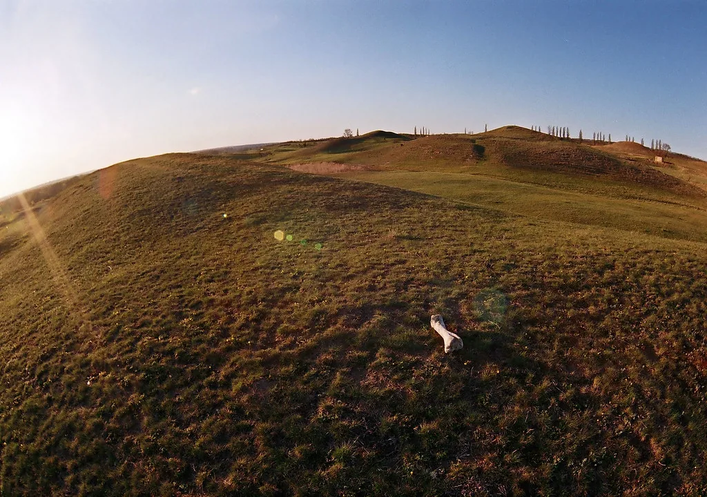
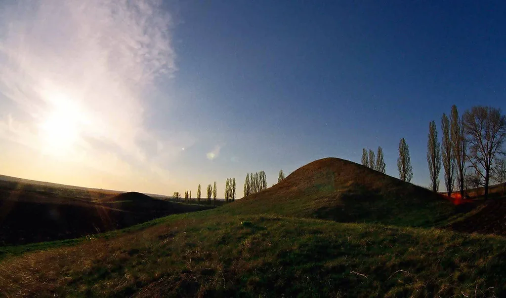
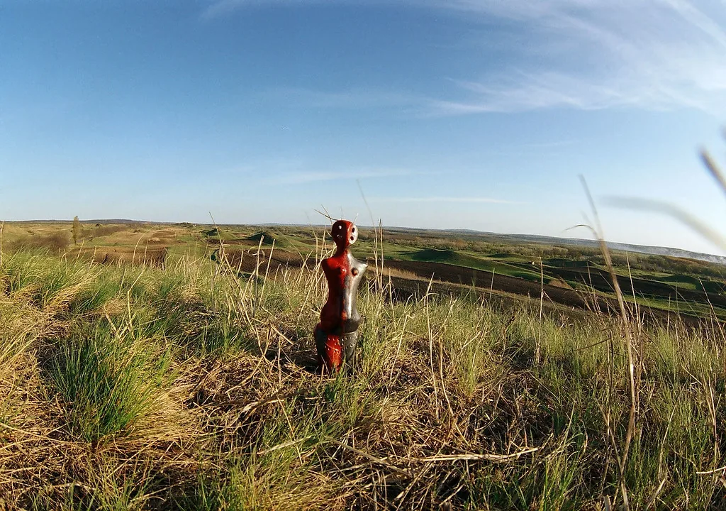
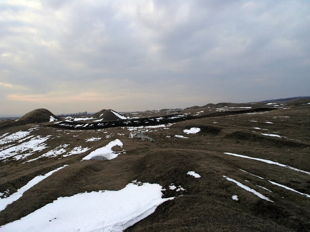
It looks like a field where the ground boiled and set again. Round mounds, some the height of a person, others the height of a ten storey block. The tallest, the Gypsy's Mound, is around thirty metres. They are not set in rows and have no visible logic, and that is where the strange feeling of the place comes from: it looks made by someone, but it is not.
Where they come from
Here is where it gets interesting, because there is no single accepted answer. Three explanations circulate.
Underwater reefs
The most widespread geological hypothesis says the mounds are the remains of reefs from the Mediterranean basin of about 20 million years ago, that is from the same warm sea that left behind the toltre of the Prut, the limestone cliffs near Duruitoarea Veche. If the hypothesis is right, the mounds and our gorge are relatives.
Landslides and settling ground
The second explanation is less romantic: surface geological processes, that is landslides, collapses and settling of the ground on the terraces of the Prut, which would have shaped the relief into its present form.
Burial mounds
The third belongs to the people of the villages: that they are mounds raised over the dead of old battles. It has no scientific support, but it has been passed down through the generations and explains why the place has always been regarded with a kind of respect.
What else is there
The reserve is a protected area of IUCN category V, that is a terrestrial landscape, and since 1998 it has been administered by two organisations: the Glodeni State Forestry Enterprise, over 657 hectares, and the "Braniste" agricultural enterprise, over 415. Oak woods grow on the plateaus, and in places oak mixes with cherry.
In 2012 the place appeared on a Moldovan postage stamp of 4.20 lei.
When to go
Many people miss this. At midday, the mounds disappear. Light from above flattens them and you think you are looking at an ordinary uneven field. The relief only shows when the sun is low, that is in the first hour after sunrise or the last two hours before sunset. Then each mound casts a shadow and, all at once, you see them all.
In early spring and late autumn the grass is short and the outlines show best. In winter, with the snow partly melted, the mounds appear as black and white waves.
How to get there from Duruitoarea Veche
It is a drive, not a walk. You head south, towards Braniste and Cobani. In the same corner of Moldova lies Padurea Domneasca, the country's first scientific reserve, so many people see both in the same day.
From Hanul Cu Noroc, at Duruitoarea Veche, this is the natural Sunday outing of a weekend in the area: on Saturday you do the cave, the museum and the lake, and on Sunday the mounds. Nicolae will tell you the exact route and help if you want a guide.
What to bring
- Good footwear. There is a lot of climbing up and down, and the grass hides uneven ground.
- Water. There are no sources on the route and no shade.
- Your camera, at the low light hours. From the top of one of the higher mounds you can see all the others.
- Nothing left behind. It is a protected natural area.
Frequently asked questions
How many mounds are there at Suta de Movile?
Over 3,500, although the name says a hundred. The heights range from 1 metre to 30 metres, and the tallest is called the Gypsy's Mound. The reserve covers 1,072 hectares, on a strip 8 km long and 1.7 to 2.3 km wide.
Where is the Suta de Movile reserve?
In northern Moldova, on the terraces of the Prut, between the villages of Braniste, Riscani district, and Cobani, Glodeni district. Approximate coordinates: 47°49′06″N, 27°18′07″E.
How did the mounds form?
There is no single accepted answer. The main geological hypothesis says they are the remains of underwater reefs from the Mediterranean basin about 20 million years ago, that is from the same sea that left the toltre of the Prut. The second explanation invokes landslides and settling of the ground. The third, the local one, says they are burial mounds left after old battles.
When is the best time to visit Suta de Movile?
In the first hour after sunrise or the last two hours before sunset. At midday, light from above flattens the relief and the mounds practically disappear. In early spring and late autumn, when the grass is short, the outlines show best.
How far is it from Duruitoarea Veche to Suta de Movile?
It is a drive south, towards Braniste and Cobani, not a walk. Many visitors combine it with Padurea Domneasca, in the same day. From the Hanul Cu Noroc guesthouse it is the natural Sunday outing of a weekend spent in the area.
Sources
- "Suta de Movile", Romanian Wikipedia. This gives the number of mounds, the dimensions, the area, the coordinates, the formation hypotheses, the IUCN status, the administration since 1998, the flora and the 2012 postage stamp. ro.wikipedia.org
- The "Padurea Domneasca" Nature Reserve. This gives the division of the area between the Glodeni State Forestry Enterprise and the "Braniste" agricultural enterprise. padureadomneasca.silvicultura.md

Stay with us and set off early
The mounds look best in the first light, and from here you set off rested. Message us and we will tell you the way.
A guesthouse in Duruitoarea Veche, Riscani district. 9 rooms and 36 beds, 100 metres from Lake Costesti-Stanca. Open from May through October.
Phone and WhatsApp: +373 798 48 077